Points of interest
Warnings
More information on the route

Assols simple dolmen

:
Maximum duration:

It’s an interesting route through Ardenya Mountains. At first, we’ll find the Camí Romà cave and then, Assols simple dolmen, near the Olles hut, on top of Riera de les Comes descending path.
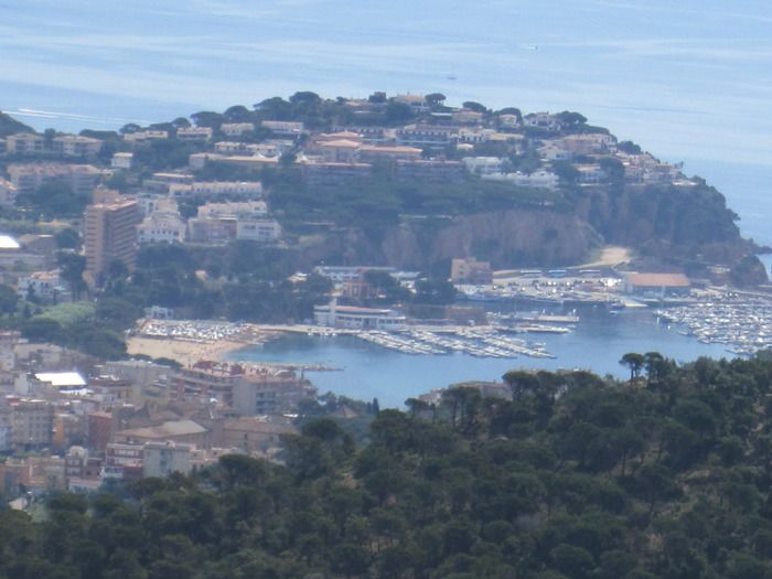
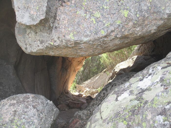
We’ll begin the ascent by the path that links can Dalmau with Can Duran mas, with great views over Roca Ponsa. From can Duran, we’ll go up to Sant Baldiri, and then, towards can Codolar, Sant Benet and the Sorres path. We’ll take the Roman path at Collet de la Mare de Déu. We’ll leave the path that would lead us to Tres Fonts behind and we’ll be on a terrace. 150 mts from here, on the rocks, we’ll find the Camí Romà cave. It’s not well known, as it was hidden among the woods for a long time. It’s corridor-shaped, opened at both sides. We’ll have a lovely panoramic view over Sant Feliu from the top of the huge stone.
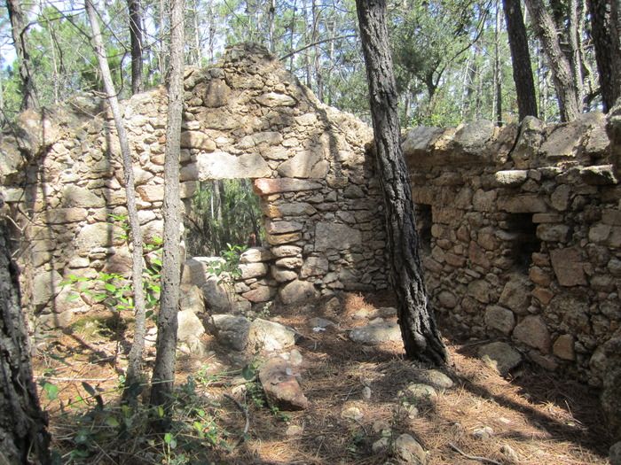
We’ll leave the Roman path behind and keep on descending to Riera de les Comes. We’ll find soon the Olles hut. It’s an old shepherd hut, made out of stone, which had pots (in Catalan, olles) stuck into the walls.
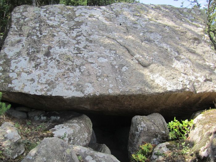
Below the hut, there is a path that will lead us to Assols simple dolmen. It’s a huge stone slab that made up a cavity, which was used as a tomb. Different stuff related to megalithic burial was found during the archaeological digs. By the coll de Portes and the Monticalvari fountain, we’ll reach Sant Feliu, happy to know a little better the rich Ardenya heritage.
29.58 Km 359.8 m 1002.9 m
5.8 m Si
Points of interest Download track
Routes
la colla bujonis
Collaborate:
">Route - Iberian settlement and aqueducts
  • Route - Sant Sebastià Lighthouse
  • Route - From Roca Rovira to Ses Balelles
  • Route - Romanyà fountains
  • Route - From Roques d'en Cases to Roques Planes
  • Route - Cova d'en Riera
  • Route - Salenys-La Verneda-Ridaura
  • Route - Lead mine (St. Cebrià dels Alls)
  • Route - Can Mont mountain
  • Route - Montigalar
  • Route - Puig dels Daus
  • Route - Verneda Basin
  • Route - Can Llac and Roquetal fountains
  • Route - Trains and Gavarres
  • Route - Can Vallfreda cork forest
  • Route - Can Poncet fountain
  • Route - Santa Maria and Sant Mateu de Montnegre
  • Route - Sant Cebrià dels Alls
  • Route - Roca de Malvet
  • Route - Moros towers in Panedes
  • Route - Bamboo cane wood
  • Route - Romanyà de la Selva
  • Route - Ganso fountain
  • Route - Valls fountain
  • Route - Santa Llúcia d'Arboç and Vall de Sorinella
  • Route - Can Gironés de les Gavarres
  • Route - Castell d'Aro fountains
  • Route - Puig d'Arques
  • More information on the route

    Assols simple dolmen

    :
    Maximum duration:

    It’s an interesting route through Ardenya Mountains. At first, we’ll find the Camí Romà cave and then, Assols simple dolmen, near the Olles hut, on top of Riera de les Comes descending path.
    We’ll begin the ascent by the path that links can Dalmau with Can Duran mas, with great views over Roca Ponsa. From can Duran, we’ll go up to Sant Baldiri, and then, towards can Codolar, Sant Benet and the Sorres path. We’ll take the Roman path at Collet de la Mare de Déu. We’ll leave the path that would lead us to Tres Fonts behind and we’ll be on a terrace. 150 mts from here, on the rocks, we’ll find the Camí Romà cave. It’s not well known, as it was hidden among the woods for a long time. It’s corridor-shaped, opened at both sides. We’ll have a lovely panoramic view over Sant Feliu from the top of the huge stone.
    We’ll leave the Roman path behind and keep on descending to Riera de les Comes. We’ll find soon the Olles hut. It’s an old shepherd hut, made out of stone, which had pots (in Catalan, olles) stuck into the walls.
    Below the hut, there is a path that will lead us to Assols simple dolmen. It’s a huge stone slab that made up a cavity, which was used as a tomb. Different stuff related to megalithic burial was found during the archaeological digs. By the coll de Portes and the Monticalvari fountain, we’ll reach Sant Feliu, happy to know a little better the rich Ardenya heritage.
    29.58 Km 359.8 m 1002.9 m
    5.8 m Si
    Points of interest Download track
    Routes
    la colla bujonis
    Collaborate: